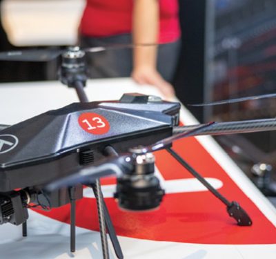
The World Meteorological Organization is planning an ambitious, but completely voluntary, program to evaluate the use of drones for filling in atmospheric gaps in weather forecasting and monitoring.
The program, formally known as the WMO Uncrewed Aircraft Systems Demonstration Campaign, is scheduled for March through August 2024, although planning is already under way and companies and organizations are already signing up to take part.
WMO is an intergovernmental organization with a membership of 193 member states and territories. Since 1951, it has served as the agency of the United Nations for meteorology, hydrology and related geophysical sciences.
For decades, WMO has collected airborne data under the Aircraft Meteorological Data Relay (AMDAR) system, which uses the sensors, computers and communications systems on commercial aircraft to collect, process and transmit meteorological data to ground stations via satellite or radio links. WMO also uses radiosondes, telemetry instruments usually carried into the upper atmosphere via balloons.
The data—including air temperature, wind, turbulence and other measurements—is relayed to meteorological services, where it is processed and transmitted on the WMO Information System, where it can be accessed by all WMO members.
WMO Scientific Officer Dean Lockett said WMO had become increasingly aware of the push to integrate unmanned aircraft into the airspace and into various uses in a more regulated and operational manner.
“We started looking into it as a potential candidate for an operational observing system,” Lockett told Inside Unmanned Systems. “So, we called a sort of workshop on this that we had back in 2019. And out of that we saw that the technology was really advancing and there were certainly a number of system operators and vendors that were pushing towards an operational solution.”
WMO isn’t looking for research efforts or temporary efforts, but instead “an observing system that’s deployed on an ongoing basis, and to support ongoing applications like, for example, numerical weather prediction.”
The Uncrewed Aircraft Systems Demonstration Campaign will be a six-month series of meteorological and hydrological observations made voluntarily by UAS operators at their own cost. The operators can be public, government or private and will conduct flights under the auspices of the WMO Commission for Observation, Infrastructure and Information Systems, or INFCOM. Within INFCOM, the Joint Expert Team on Aircraft-Based Observing Systems (JET-ABO) will be responsible for coordinating related planning and activities.
The effort has several main goals:
• To demonstrate current capabilities of a range of UAS and to measure their capacity to contribute to meeting operational requirements for upper-air observations and the filling of observational gaps of the WMO Integrated Global Observing System (WIGOS) Global Basic Observing Network (GBON) and Regional Basic Observing Network (RBON);
• To demonstrate the capacity of UAS and their data processing systems to provide data in an interoperable format ready for use by relevant applications and forecast systems;
• To measure, analyze and report on the impacts of UAS observations on relevant WMO application areas and forecast systems;
• To determine more generally and report on areas of development needed for UAS to adequately meet requirements to efficiently, economically and environmentally responsibly contribute operationally to WIGOS;
• To determine and make recommendations relating to regulatory conditions imposed on UAS that impact their ability to contribute to WIGOS.
Filling the Gap
The goal is to fill a gap in atmospheric readings from areas where aircraft, manned or unmanned, typically don’t or can’t fly, to bolster data from the radiosondes and to understand the regulations restricted some of those flights.
“That requirement is almost being dictated by the fact that we can’t really get into other parts of the airspace just yet,” Lockett said. “I think if there were no regulatory restrictions on [UAS] use, they’d be everywhere. And they’d definitely be used for operational meteorology because if there’s no restrictions, you can, you can fly them.”
One goal is to look at current airspace access and “try and mount a case for less restrictive access,” Lockett said. …If we were asking today to be able to get permissions to fly radiosondes in current aspects, we probably wouldn’t get them, or there would probably be greater restrictions, safety requirements imposed than what we have.”
Unmanned aircraft could currently take over some of the measurements handled by radiosondes, he said, including instruments carried by balloons, “so, yeah, we’d certainly like to see the regulations relax, but at the same time understanding that we will have to demonstrate certain capabilities and demonstrate the safety, all those sorts of things.”
Although the flights aren’t scheduled to begin until next spring, Lockett said the WMO is holding meetings and planning for the campaign now to give participants time to raise funds if they need to. So far, the campaign has received interest from about 50 operators, including entrants from government, academia and industry, some of which might operate from multiple sites.
Interested universities include Embry-Riddle Aeronautical University, the University of Bergen, Virginia Tech University and the University of Kentucky, and companies interested include Black Swift Technologies, Meteomatics, Stratodynamics Aviation and Surveyar Ltd.
“I think if we get the numbers that have indicated they will participate at this stage, then I think we have enough to have a good campaign and to get something out of it,” Lockett said.