The app for independent voices
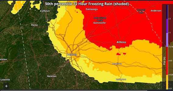
One of the areas that I am very interested to see how things play out is around the Atlanta metro. An ice storm warning is in effect for the region, but the models show that it will be on the southwest edge of the “wedge” of Arctic air, with the NWS National Blend of Models only showing ice accumulations of around .1” in ATL proper, with a significant gradient from southwest to northeast across the area. The impacts in this region will be very dependent upon how the wedge evolves as I discussed in my morning newsletter.

Jan 23
at
11:59 PM
Log in or sign up
Join the most interesting and insightful discussions.

