The app for independent voices
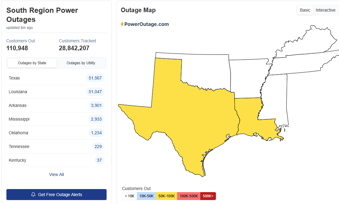
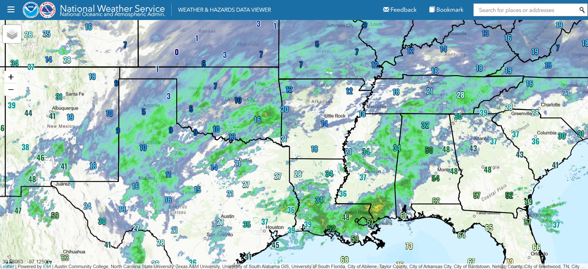
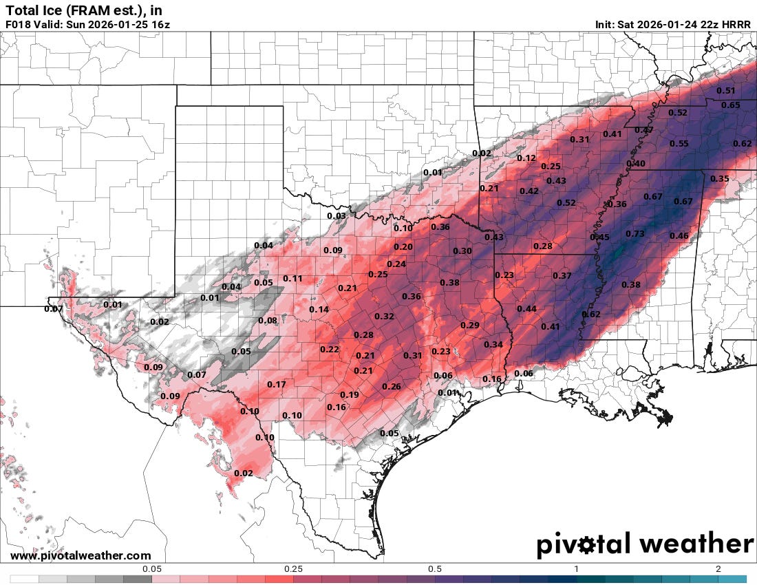
More than 100K customers without power as of 6 pm CT from northeast Texas across northern Louisiana due to ice accumulations. The more substantial ice accumulations are still yet to come as areas of heavy precipitation upstream across southern Louisiana across Texas continue to develop and spread northeast through the evening. The most recent high resolution model suggests swaths of .3-1” of additional ice accumulation through 10 am CT Sunday across much of eastern Texas, Arkansas, northern Louisiana and Mississippi, and into western Tennessee and Kentucky. Freezing rain will still be ongoing across Mississippi and Tennessee and points northeast at that time, causing additional accumulations. Significant additional power infrastructure and tree impacts are expected across these regions.
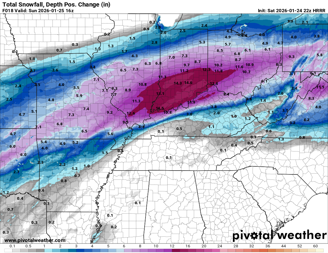
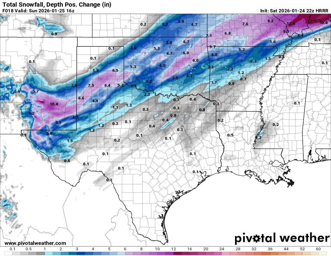
Meanwhile, heavy snow will continue to the northwest with sleet mixed in within the broad transition between snow and freezing rain. While the snowfall forecast by the most recent HRRR in the Ohio Valley may be somewhat overdone due to extensive sleet, regardless the combination of heavy snow and sleet will cause serious impacts including nearly impossible travel.
