The app for independent voices
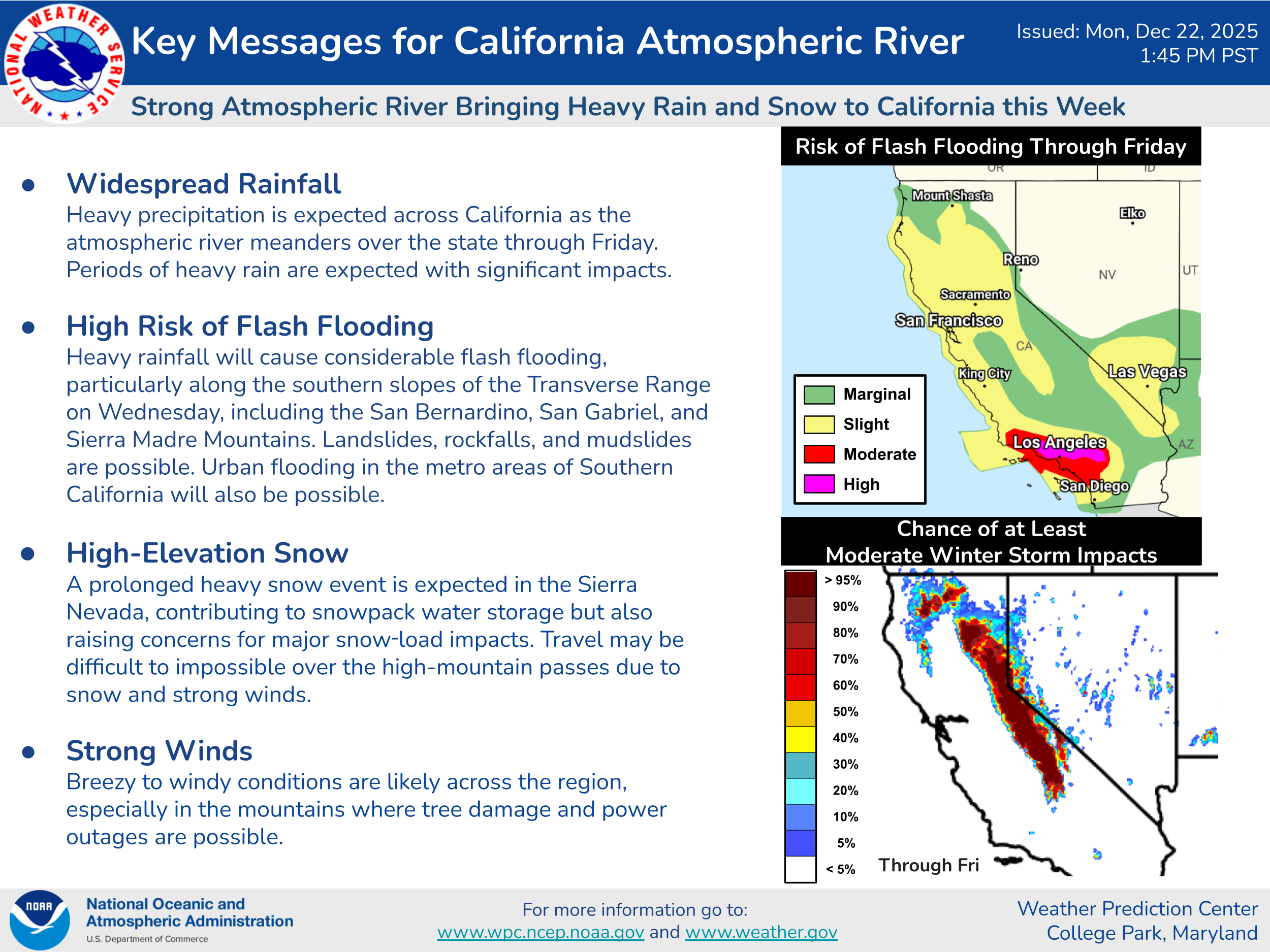
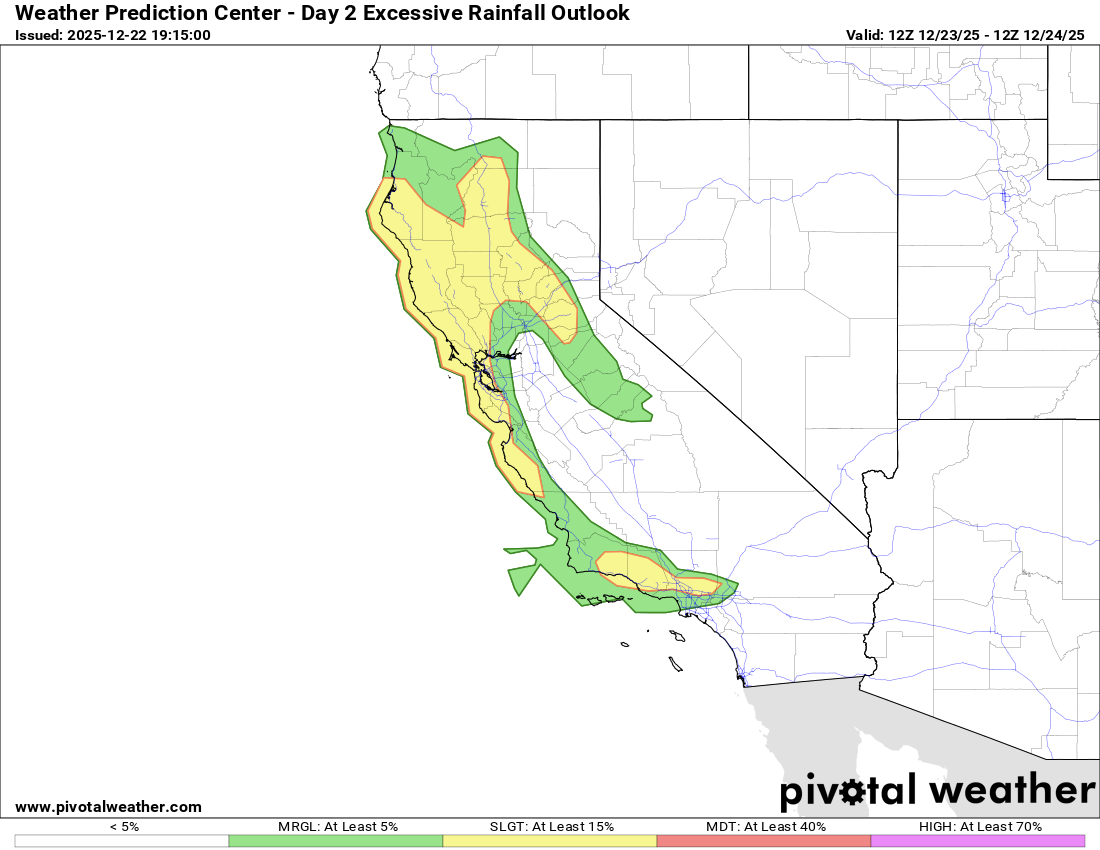
The NWS Weather Prediction Center has issued a rare day 3 high (level 4 of 4) risk of excessive rainfall and flash flooding for the Transverse Ranges of southern California for Christmas Eve, with a larger moderate (level 3 of 4) risk including most of the southern California urban corridor. WPC is calling for widespread rainfall amounts of 4-7” over an 18 hour period with isolated amounts of up to 10” which will likely cause significant urban flooding, landslides and potential debris flows in burn scar regions.
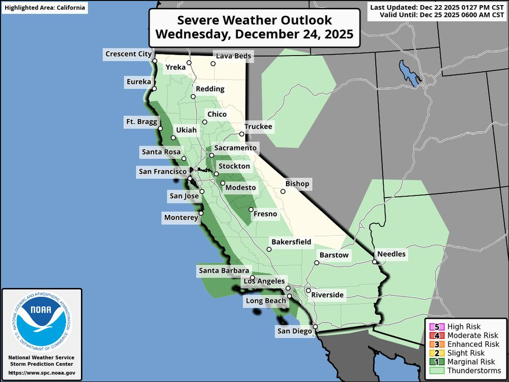
The flood threat will begin to ramp up across the state on Tuesday as a strong area of low pressure begins to develop offshore of California and move north northeast toward the Oregon/California border. This storm system is also expected to bring strong winds (potential gusts 60+ mph) to areas near the coast from central California north with strong winds also expected in higher elevations of northern California and Oregon — high wind warnings and wind advisories are in effect for many areas. Finally, a few severe thunderstorms with damaging winds and tornadoes are possible late Tuesday night into Christmas Eve along the California coast and in the parts of the central valley.
A second low pressure system with additional hazards — including very heavy Sierra snowfall — is expected on Christmas Day. More details on all of this in the regular newsletter tomorrow morning.


