The app for independent voices
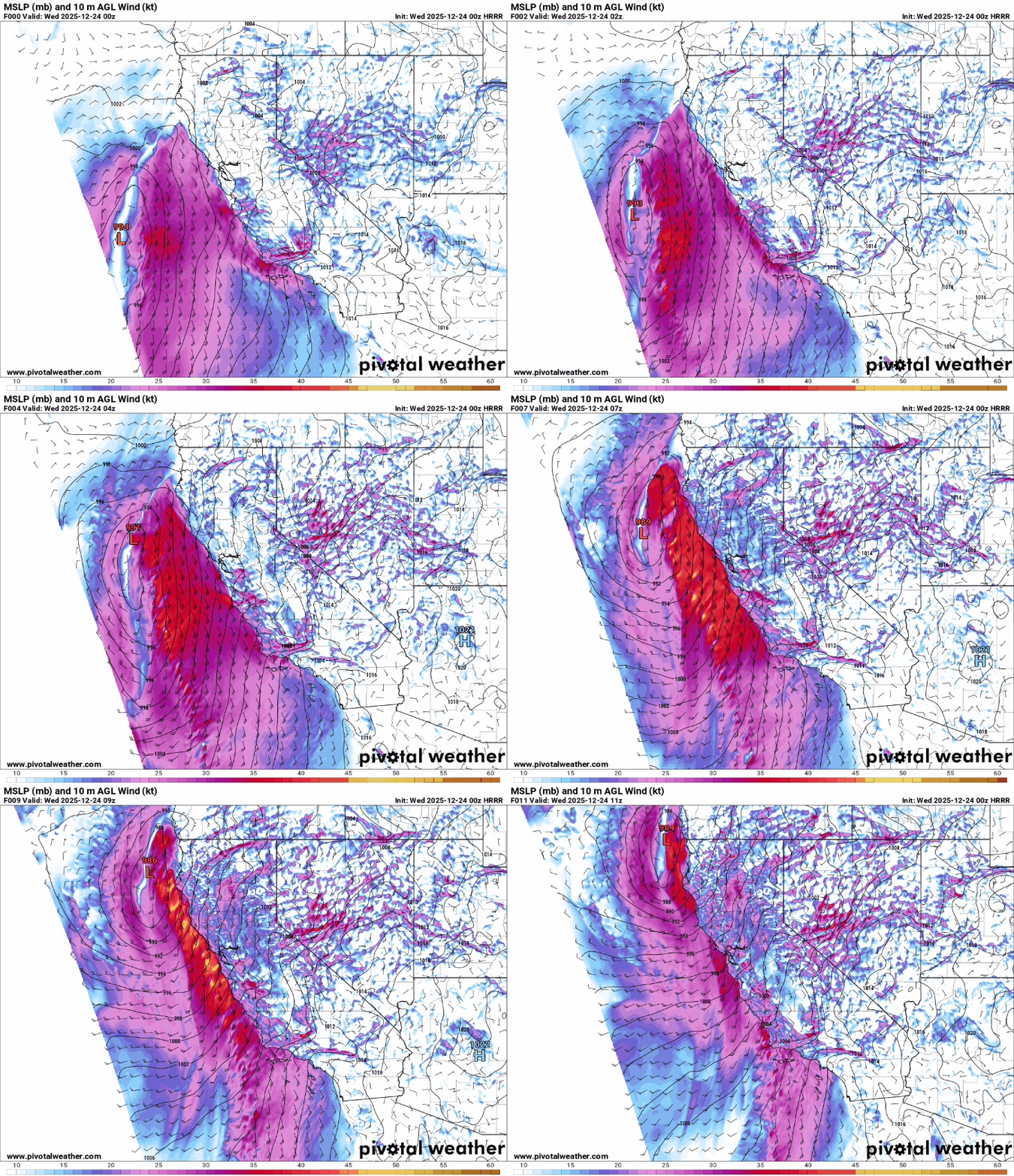
Evening high resolution models show a stronger trend for the developing low pressure system off the California coast. This low will move toward the coast and be near the coastline along the CA/OR border by morning. The trend toward a stronger system may mean somewhat stronger wind gusts than earlier anticipated along the coast and particularly toward northwest CA and southwest OR. Additionally, the model shows a pretty strong signal for low topped rotating thunderstorms in a band that will approach the coast in the post-midnight hours. These storms could produce damaging wind gusts and perhaps a brief tornado as they move onshore, but should weaken as they move farther inland.
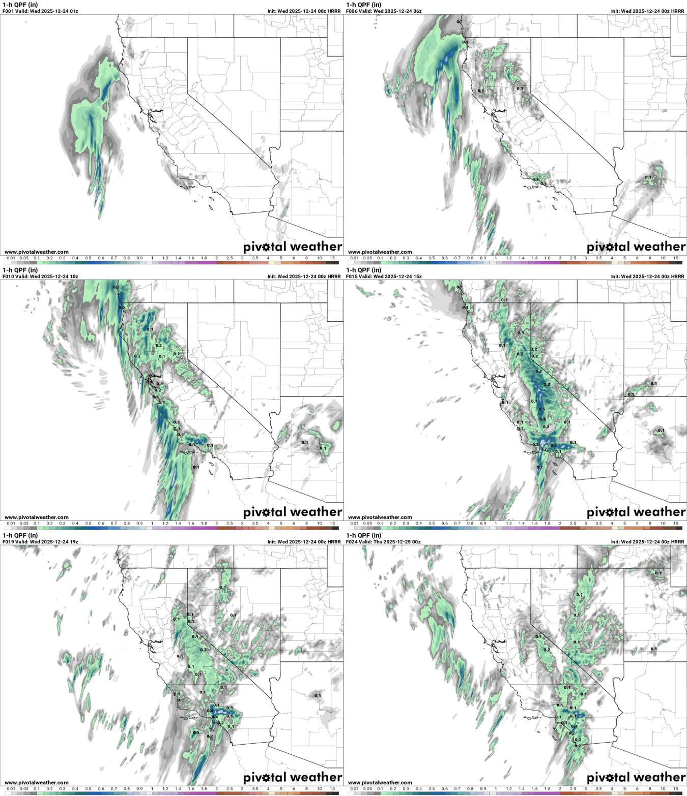
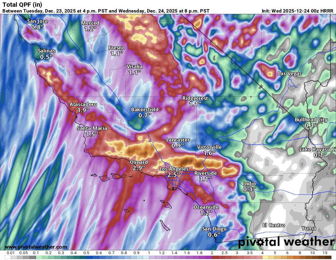
Farther south, heavier rain and showers will begin to impact southern California after midnight. The loop of one hour rainfall shows that hourly rainfall rates could exceed an inch at times by Wednesday morning in the higher terrain north of LA, and continuing into the afternoon particularly in areas just northeast of LA. These types of rainfall rates could certainly cause flash floods and mudslides, as well as some debris flows in burn scar areas. The high resolution model shows rainfall totals just by Wednesday evening of 2-4” in the LA basin with 5-10” in the foothills and mountains north of LA, and isolated amounts of 12”. Waves of moderate to heavy rain will continue to impact the region into Christmas Day, exacerbating flooding issues.


