
New Bahamas Guide Scores on a Triple
New Bahamas Guide Scores on a Triple
App Platform Combines Clever Tech and 'Granular' Local Knowledge

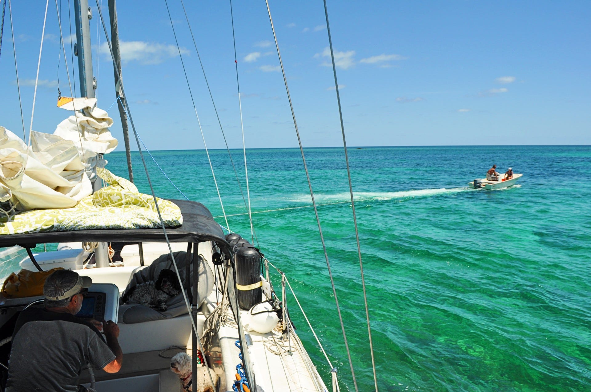
Last time we visited the Abacos we cleared in at Grand Cay, which was the last time I saw bossman Rosie before his death in February 2023. After a couple nights at anchor, we steered Rio toward the inner anchorage at Double Breasted Cay.
We were using the Explorer Charts on paper then, trying to follow the colored-line sailing directions coming in from the north. There’s a point where you are supposed to jog to starboard and then gradually turn to port until you’re pointed south into the anchorage.
Alas, we did not adequately jog. Standing watch on the bow, my crew hollered STOP! about a millisecond before we went hard aground. A dive boat operator in the anchorage came by in his center-console and tried to pull us to deeper water, but no, we were going to have to wait three hours for the tide, which we did, and everything turned out fine.
This tale of a routine cock-up is what everyone nowadays calls a “teachable moment,” though the corrective was still years away back then. Now the moral of the story has finally arrived. The Bahamas Land & Sea app was published or the first time in 2023 under the auspices of Waterway Guide.
And this is what it looks like when a GPX-format route in the app is loaded—two buttons pressed—into Aqua Maps cartography on an Android device. It works with Navionics, too. Scaled up, the path to the anchorage would have been unambiguous. For anyone with an ancient plotter, the waypoints are listed for manual input.

Author Addison Chan has wisely limited the route-sharing feature to places that are tricky, unlike the Bob423 ICW Cruising Guide, which has users adhering zombie-like to a non-stop path half the length of the East Coast (not that such an approach would be practical in the unconfined waters of the Bahamas.)
Embedded routes are just one reason that this guide is not only best in class but sets the standard for all future cruising guides.
“The real story here is the platform. The guide just takes advantage of the tools available,” Chan said. “There are thousands of hours of engineering to make this work. The hard part is to make it seem easy.”
Here, the author has managed to boast, yet there is humility in what he leaves unsaid. The sine qua non of any good cruising guide is the quality of the information, without which a whizzy platform and deft organization would be for nothing. Chan knows his subject matter.

For years, I’ve watched him field questions on this Bahamas Land & Sea Facebook page. Having spent probably two cumulative years of my own life wandering around those islands, I’ve seen enough to have acquired a pretty effective bullshit detector.
As far as I can recall, Chan has never given an answer that I could even quibble with. The descriptive has become a cliche, but “granular” is a good word for his familiarity with the areas covered by the guide.
The text is augmented by the use of screenshot chart briefings. Sections can be downloaded for use offline (except for satellite imagery). The guide is searchable, of course, and there is a book-mark feature.

Swims With the Fishes
Plenty of people cruise the Bahamas just to drink and socialize, but the beauty and the riches of this 590-mile-long archipelago lie in its waters, including what’s under them. Chan is expert in diving and fishing, and brought this to the guide better than any of his predecessors.1
My only criticism is that Chan’s guide doesn’t go far enough—literally. It doesn’t cover the following out-island locales: Crooked & Acklins islands, San Salvador, Plana Cays, Samana Cay, Mayaguana, the Inaguas and Jumentos. Some of these are crucial for adventurous cruisers en route to the Turks & Caicos and Caribbean or to the North Coast of eastern Cuba.
Disclosure: I was editor of Waterway Guide under a previous administration, and I’m pretty sure the company wasn’t making a nickel then, unless you count expensing for tax purposes the fuel and maintenance for the owner’s “research vessel,” a fancy motoryacht. Publishing cruising guides is a business, and it makes sense to taylor your efforts to the market.
Chan was asked about the decision to limit coverage. “Everything in the current guide is the result of multiple trips, and I can’t say that about the areas you asked about. I figured quality was more important than quantity,” Chan said. “At the end of the day it’s 80/20. I wanted to cover the 80 percent, which are the critical areas for over 90 percent of readers at as close to 100 percent as possible.”
For the rest us, Chan promised to add a chapter to be entitled “Far Out Places” sometime in the future. For sure, you are never going to get the majority of the George Town crowd to move beyond their suburban harbor, but with better intelligence, more would be likely to try.
Everyone would agree that it’s nice to have solid info about the Abacos, Exumas, etc., but these places are well traveled and therefore generally familiar. Let’s look at it from the point of view of that 10 percent that wants to go further, however.
Having embedded routes for entering the reef anchorage at Samana or departing the Mayaguana anchorage at the eastern cut through the reef would be pure cruising gold. How about a route into Lantern Head Harbour at Great Inagua, and what kind of protection would it afford should a frontal system actually reach that far south?


With lessons on places and tactics beyond George Town, Bruce Van Sant’s “Gentleman’s Guide to Passages South”—outdated ink on paper—continues to provide great value, albeit to that smaller cruising cohort. (So, of course, Van Sant never got rich on his books, either.)

There’s no reason Van Sant’s guide could not be re-rendered using Chan’s novel platform. Indeed, we are going to see other examples of it, as Chan said:
Doyle Guides is doing this in the Caribbean, Cruising Guide Publications are putting their catalog on line, and I’ve got other irons in the fire. It’s not just cruising guides, anything that is currently in print, could be turned into a fully custom app in a few hours. We are working with the Seven Seas Cruising Association and the American Great Loop Cruising Association through Waterway Guide and some marinas.
The goal here is to allow non-programmers to create and manage apps. Anybody who is familiar with print production can be shown how to use this platform in less than an hour. There is nothing like this anywhere. I’d really like to get to weekly community newspapers, but I’ve been busy getting the guide out. Now that that’s fine, I’ll have more time to focus on futures.
After all, Addison Chan is Canadian. I used to joke that you knew when no lobsters remained on a nearby reef because all the French-Canadian sailors in the anchorage had started to move on.
Sitting in Cat Island now. Addison Chan always gives solid advice without any hint of a demeaning attitude. He is so nice and informative in his answers on FaceBook. Yep, he is Canadian!
Relying solely, or even to a large degree on digital information without incorporating consistent use of hard copy charts and cruising guides is foolish. Are you mariners, yacht technicians, cruisers, divers, fisherman and sun lovers or IT geeks?